


Adamsville Baptist Church, Jefferson County, Alabama
About
Outline

Summary
| Unique Area Identifier | 522019 |
| Name | Adamsville Baptist Church |
| County | Jefferson County |
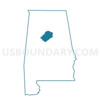
| State | Alabama |
| Area (square miles) | 16.59 |
| Land Area (square miles) | 16.47 |
| Water Area (square miles) | 0.12 |
| % of Land Area | 99.28 |
| % of Water Area | 0.72 |
| Latitude of the Internal Point | 33.60578250 |
| Longtitude of the Internal Point | -86.99409500 |
Maps


Graphs
Select a template below for downloading or customizing gragh for Adamsville Baptist Church, Jefferson County, Alabama


Neighbors
Neighoring Voting District (by Name) Neighboring Voting District on the Map
- Adamsville Senior Citizens Building, Jefferson County, AL
- Masonic Lodge West Jefferson, Jefferson County, AL
- Maurice L West Community Center, Jefferson County, AL
- Maytown Baptist Church, Jefferson County, AL
- Mulga Town Hall, Jefferson County, AL
Top 10 Neighboring County Subdivision (by Population) Neighboring County Subdivision on the Map
- Birmingham CCD, Jefferson County, AL (455,278)
- Graysville-Adamsville CCD, Jefferson County, AL (10,762)
- Maytown-Sylvan Springs CCD, Jefferson County, AL (3,829)
Top 10 Neighboring Place (by Population) Neighboring Place on the Map
- Adamsville city, AL (4,522)
- Graysville city, AL (2,165)
- Sylvan Springs town, AL (1,542)
- Maytown town, AL (385)
Top 10 Neighboring Unified School District (by Population) Neighboring Unified School District on the Map
Top 10 Neighboring State Legislative District Lower Chamber (by Population) Neighboring State Legislative District Lower Chamber on the Map
- State House District 15, AL (48,965)
- State House District 60, AL (36,704)
- State House District 55, AL (35,572)
Top 10 Neighboring State Legislative District Upper Chamber (by Population) Neighboring State Legislative District Upper Chamber on the Map
Top 10 Neighboring 111th Congressional District (by Population) Neighboring 111th Congressional District on the Map
Top 10 Neighboring Census Tract (by Population) Neighboring Census Tract on the Map
- Census Tract 125, Jefferson County, AL (4,454)
- Census Tract 121.03, Jefferson County, AL (4,146)
- Census Tract 123.02, Jefferson County, AL (3,829)
- Census Tract 124.03, Jefferson County, AL (3,592)
- Census Tract 121.04, Jefferson County, AL (3,024)